GPX Planner
Plan the ride on a big screen; it's on your phone before you gear up.
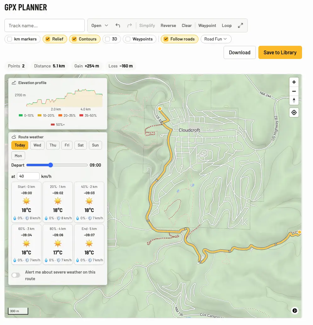
Drawing a route
Open the GPX Planner and click the map — each click extends the route. Drag points to adjust, click on the line to insert one, undo/redo anything (⌘Z / ⇧⌘Z). Distance, elevation gain/loss, and a live elevation profile update as you go, and drafts save themselves.
Follow roads
Flip on Follow roads and clicks snap to the road and track network instead of drawing straight lines — routed offline-style, right in your browser. Pick the appetite under Routing profile: Road Fast, Road Fun, ADV, Off-Road, Extreme — the same five profiles the phone's ADV Routing uses, so what you plan is what you'd ride.
Round trips
Ride a loop builds a closed ride from a start point, a budget, and a direction — then drops it into the planner as an ordinary editable route, anchors and all, so you can drag it around afterwards.
- Budget by distance or by time. A time budget is seeded from the profile's assumed pace and then refined against what the router actually reports — most planners only take a distance.
- Pick a direction, or leave it on Any and it fans out across the compass and keeps the best.
- Try another cycles through the alternatives it found.
Loops run through the same dirt-aware profiles as everything else, and anything too close to a there-and-back is rejected before you see it.
Seeing the terrain
The 3D toggle tilts the map and drapes it over real elevation, so a route reads as ridges and valleys instead of contour lines. It uses the same elevation data as the hillshading and the profile chart, drag to orbit, and the compass button brings you back to north and flat. Your choice sticks between visits.
Waypoints and layers
- Waypoint mode — click the map to drop a named point (fuel, water crossing, campsite) with a note.
- Toggle terrain hillshading, contour lines, distance markers along the route, and your saved waypoints.
- Route weather (ADVx Pro) — hour-by-hour forecast along the route, timed to your departure. Ride that route in the app later and the same watch follows you: severe weather ahead raises a banner in the Navigator (details).
In, out, and off to the phone
- Load GPX from Library or Upload from device… to edit an existing track; Merge GPX from Library stitches tracks together.
- Simplify track thins over-dense recordings without changing the shape.
- Save to Library and it's immediately in the apps' GPX Tracks & Navigation picker — or Download GPX for anything else.
- Reverse route direction flips it; full-screen mode when you want just the map.
Your file, unmodified
Upload a GPX and the file you uploaded is the file you get back. Download GPX on a track you uploaded returns your original bytes — not a re-export, not a re-snapped copy, not a "route" quietly turned into a "track". Nothing rewrites it in the background, and no waypoint gets dropped to fit a limit.
The limits, stated plainly rather than discovered on the trail:
- The planner edits up to 2,000 points. Import something denser and it's simplified to that for editing — the planner tells you when it does, and your stored file is untouched.
- An uploaded or recorded track can't be overwritten from the planner. Edit one and Save to Library writes a new track; the original stays exactly as it was. Only tracks the planner itself drew offer to overwrite.
- Waypoints have no cap — all of them import, and all of them come back out.
Good to know
- Follow-roads snapping runs on the same map data as the phone — it needs the region to have a routing pack published, which nearly all riding regions do.
- Long legs snap in segments; if two points are too far apart to route in one go, add a point in between.
- Distances, the elevation profile, and the distance markers follow your Account Details → Units setting. Pick Metric or Imperial outright rather than System default if you want every page on the site to agree.