ADV Routing
Point at the map, pick how dirty you want it, ride.
ADVx Pro — what's included
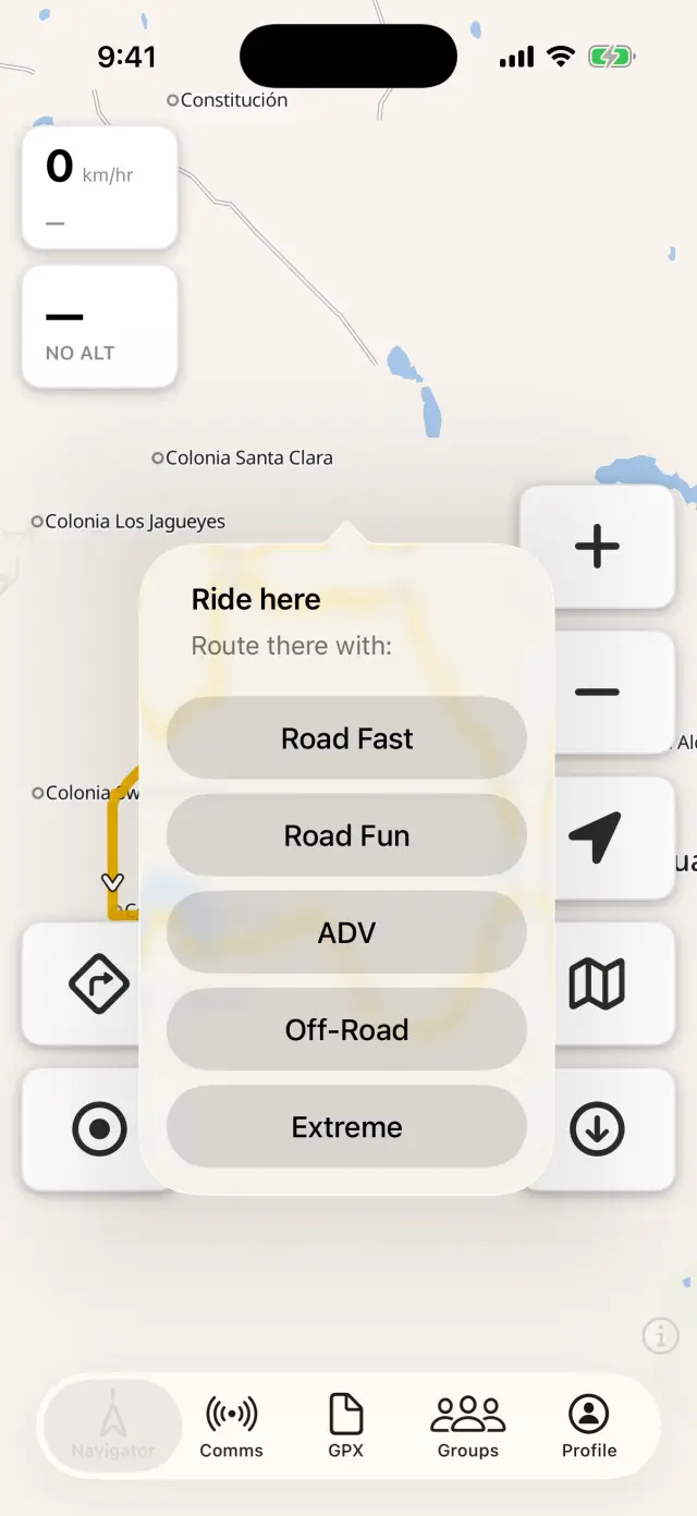
Ride here
- Long-press anywhere on the map → Ride here. Or tap a place, POI, or one of your waypoints → Ride to <name>. The map button opens the same Ride to screen, with offline search, POI filters and your waypoints in a list.
- Pick a profile. The route is computed on the phone, from your downloaded maps — mid-desert with no bars works exactly like your driveway.
- Go. Full turn-by-turn: voice cues, off-track alerts, reroutes — same as riding a GPX track.
The five profiles
- Road Fast — quickest way there. Highways welcome.
- Road Fun — pavement, but the kind with corners. Avoids the boring slab.
- ADV — mixes in dirt roads and tracks wherever they make sense.
- Off-Road — actively hunts the unpaved way, pavement only to connect the dirt.
- Extreme — maximum dirt appetite. If a track exists, you're on it.
Change your mind mid-ride: long-press the navigation button → Routing Profile — <current>… → "Reroute to your destination as:".
Ride a loop
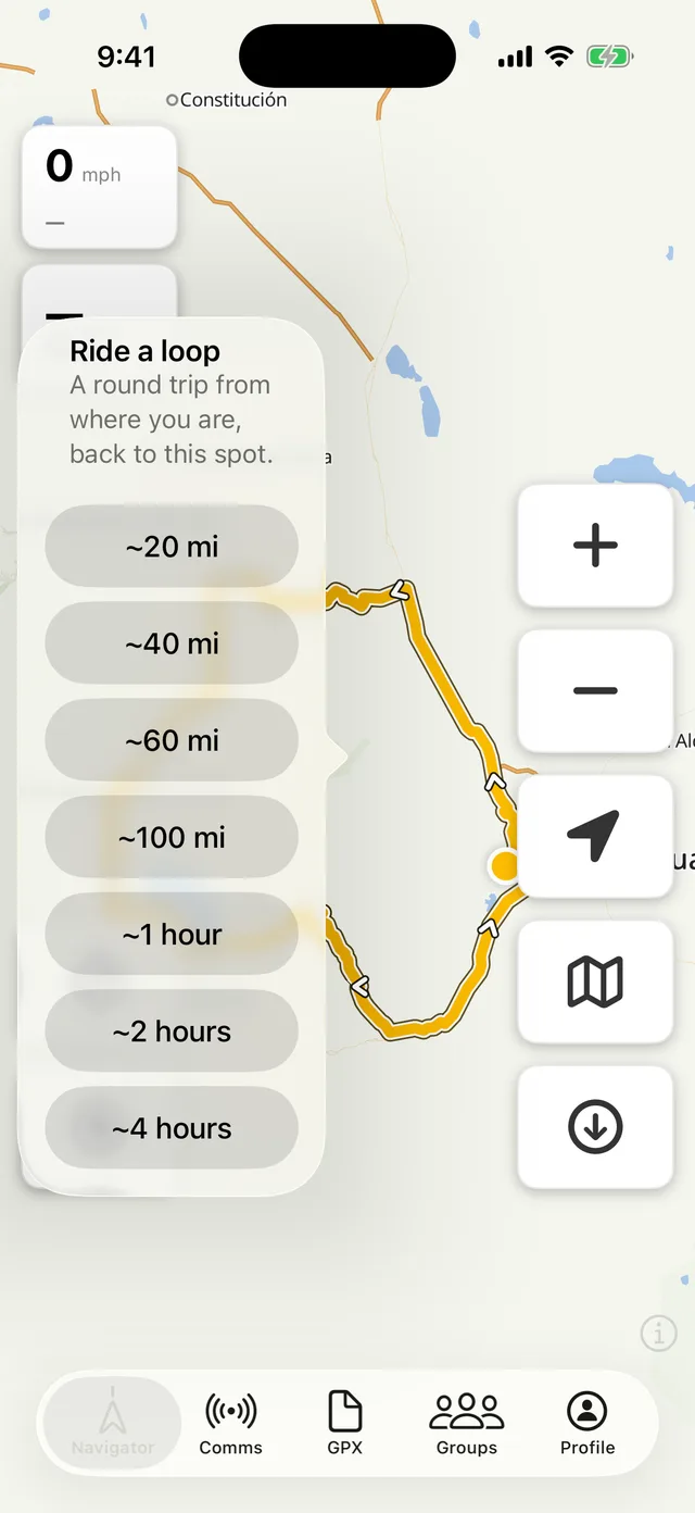
No destination in mind, just an afternoon? Ride a loop — in the Ride to screen, and on both car screens — builds a round trip from where you're standing back to the same spot.
Pick a budget and it does the rest:
- By distance — ~30/60/100/150 km, or ~20/40/60/100 mi if you ride in miles. Round numbers in your own units, and the loop is built to the figure you picked, not converted from the other one.
- By time — ~1, 2, or 4 hours. Seeded from the profile's assumed pace, then refined against what the router actually reports. Most planners only take a distance; a time budget is the one riders ask for and rarely get.
It routes with whatever Routing profile is current, so an Off-Road loop and a Road Fun loop of the same length are very different afternoons. Loops are ranked for roundness before you see one — a there-and-back with a turn at the end is not a loop, and won't be offered. The app fans out in several directions and gives you the best of them; if you want to compare alternatives side by side, the GPX Planner has a Try another button for exactly that.
One thing to know: a generated loop has no single destination, so there's nothing for auto-reroute to aim at. Wander off and it won't drag you toward a finish line — it waits for you to rejoin, or you can skip ahead.
Why it picks different roads
Most "scenic" or "curvy" routers optimise one thing: how much the road bends. They have no idea what the road is made of — which is how riders end up on a farm track in a car-width rut, or on a road that was a good line on paper and gravel in practice.
ADVx routes on the surface itself. Every way carries what the map knows about it — paved, gravel, dirt, sand, how rough, how well maintained — and each profile weighs that differently: Road Fun pays a stiff penalty to leave pavement, Extreme pays one to stay on it. It's the same data the ADV overlay draws on your map, so the line the router picks and the surfaces you can see agree with each other.
That's also why the router refuses some inviting-looking tracks: foot and MTB paths are drawn distinctly from rideable tracks, and closed to motor traffic either way.
What it needs
The region's ADV Routing pack, downloaded in Offline Maps. If you long-press somewhere without one, the app tells you exactly which pack to grab ("Download <region>'s routing pack to ride there.").
Good to know
- One leg tops out around 700 km / 435 mi — for a monster day, route to a fuel stop and continue from there.
- Routes cross region borders fine when the neighboring packs are from the same build — keep Update all in the habit loop.
- "No route found" usually means the destination isn't reachable by anything the profile is willing to ride — try a nearby point or a dirtier profile.
- Even Extreme won't send you down a foot path or trail — those are closed to motor traffic, so the router treats them as walls. On the map they're the thin dotted lines (tracks are the solid brown dash). If a promising track chain refuses to route through, look for a dotted segment in the gap: that's the router being right, not broken.
- The same profiles live in the web GPX Planner's "Follow roads" mode, so you can plan with the same brain the phone routes with.